Ushuaia is proud to be the end of the world.
Spending at least one or two days exploring Tierra del Fuego National Park in Ushuaia, the southernmost tip of Patagonia, Argentina, and the world (at least it feels like it!) is a must.
For a national park it’s rather small but it is fill with beautiful trails for all skill levels.
This post a guide on how to visit Tierra del Fuego National Park,
QUICK NOTE: This post contains affiliate links and Sol Salute may receive a commission for purchases made through these links, at no extra cost to you.
NOTE ON TOUR OPERATORS: I link to tours on three tour aggregators – GetYourGuide, Viator, and Tangol. All are reputable. I do my best to find the most affordable option of the three but prices and availability can vary.
A Guide to Tierra del Fuego National Park, Ushuaia
Parque Nacional Tierra del Fuego is incredibly easy to visit, whether by guided tour or on your own.
It is easily one of the best things to do in Ushuaia.
The park’s entrance is only around 17 kilometers from downtown, reachable in around 15 minutes by car.
Once there, the portion of the park that is accesible to the public is actually quite small but packed with beautiful vistas and trails.
In the center of the park there’s a visitor center, Alakush Centro de Visitantes. There’s a restaurant, informational center, and it’s also the only bathroom in the park (important).
TIP: If you plan on spending two days in the park purchase your tickets together. The second-consecutive day is half-price.
How to Get to Tierra del Fuego National Park
There are a few ways to reach the park’s entrance.
We rented a car for our time in Ushuaia and enjoyed the freedom to move around. Check rental rates here for your dates.
Don’t want or need a car?
Here are the 4 best ways to reach the park…
Shuttle
There is a shuttle bus you can take to the park, departing every one to two hours from the bus terminal at Avenida Maipu and Juana Genoveva Fadul Sur. You can also hire taxis/remis here.
The buses start at around 8 am and have three stops in the park.
Confirm with the driver what time the shuttles will be at the stop to return to Ushuaia at the end of the day to avoid a long wait.
We had a rental car so I can’t speak from personal experience but I did see the white vans all over the city. I also saw bored hikers waiting for their shuttle back, so try to coordinate the return time as best you can.
Read Next: The Most Beautiful National Parks in Argentina
Take a Taxi
Since the park is so close to town, it’s affordable to hire a taxi (or remis) there.
Have them drop you off at your trailhead of choice and arrange a pick up time for later that afternoon at a designated place.
It is common to get dropped off at the Costera trailhead and be picked up at the end of Ruta 3 at Lapataia Bay (for more on that skip ahead in this article to How to Hike Across the Park).
Take the Fin del Mundo Train
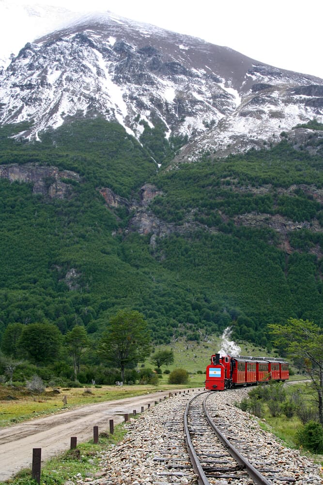
Train enthusiast? Take the historic End of the World Train to the park!
While it may feel touristy, this train played an important role in Ushuaia’s history. It transported prisoners from the city to the mountains to mine construction materials. The train operated from 1910-1947.
Today the train is a bit more leisurely (ha), even with first class options. It runs the final 7 kilometers of the original route, ending in the Rio Pipo area of the park.
You can spend a short 15 minutes exploring the station before returning or choose the option to return later in the day after spending your day in the park (more recommendable).
4 Areas of the Park to Explore
Here are the main areas and highlights of the park to visit.
Overall, the park is easy to navigate. There aren’t many roads to get lost on. Ruta 3 (the road you take from Ushuaia) crosses the entire park and ends in Lapataia.
There is a road that intersects with Ruta 3 early on in the park. It leads to the Post Office and Ensenada in one direction, and Rio Pipo in the other.
Then at the Alakush Visitor Center there is a road that leads to Lago Acigami and its trails. That’s basically it.
The End of the World Post Office
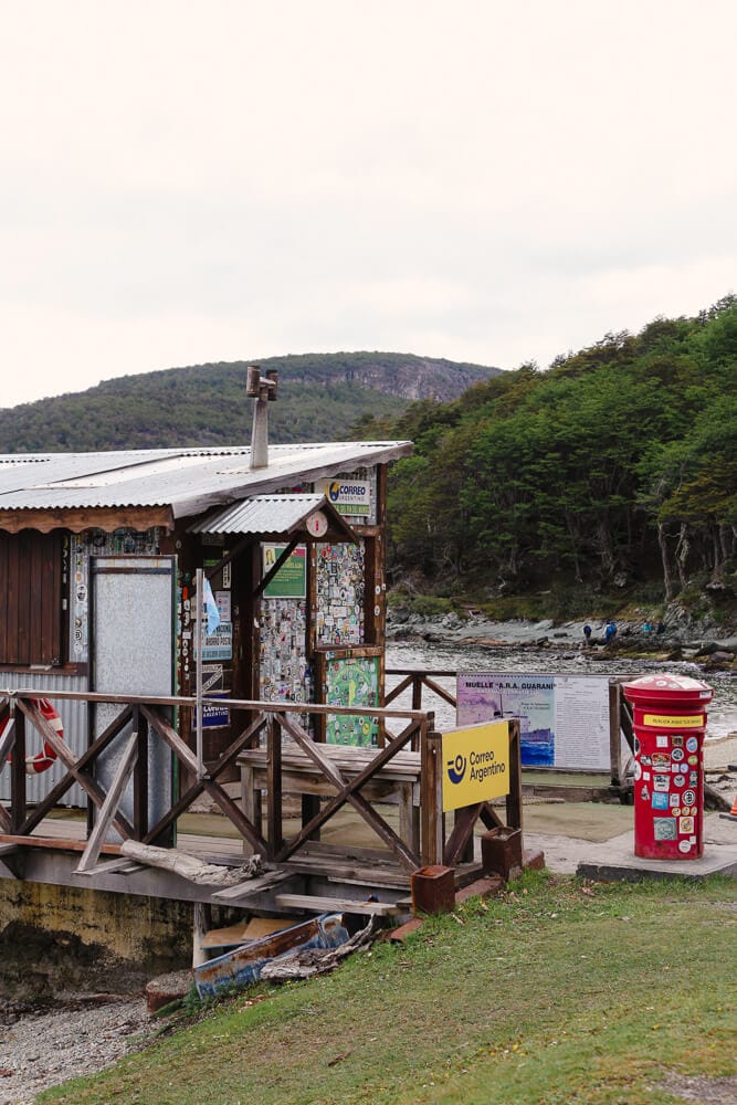
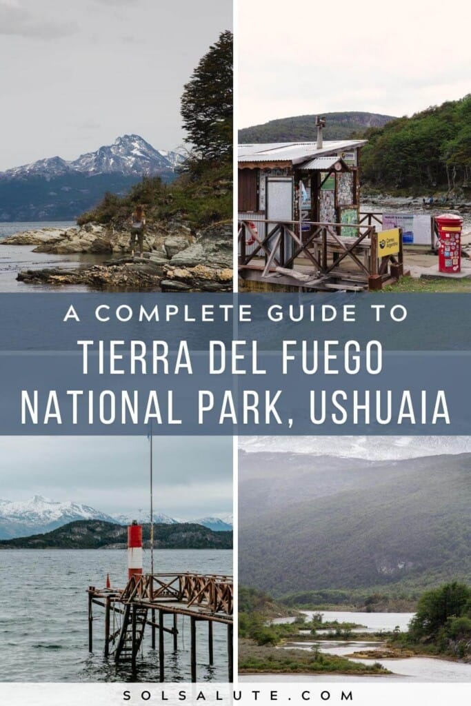
In Bahia Ensenada Zaratiegui, before you embark on the Senda Costera, pay a visit to the End of the World Post Office.
This corrugated iron building sits on a precarious dock over the water. Step inside and purchase a postcard or five to send to your loved ones back home.
Fill it out and have it stamped with official end of the world stamps (and some from novelty penguin stamps for good measure).
I loved our visit to the post office (the fire inside on a cold day didn’t hurt) but I would have enjoyed it more had I known it’s quirky anarchist history! Read about it here on Accidentally Wes Anderson (so perfect).
Río Pipo
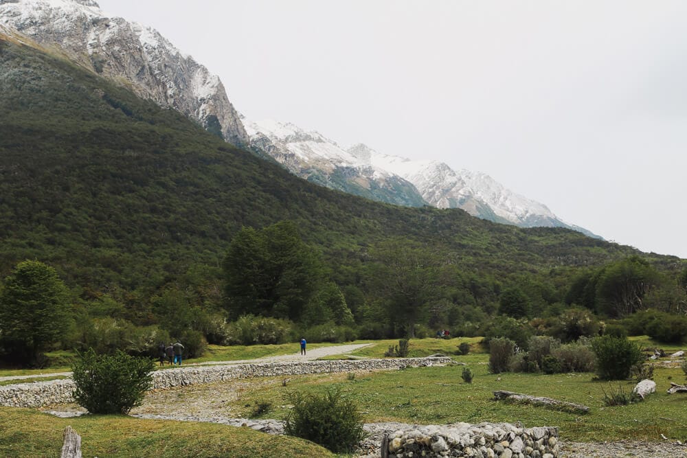
The Río Pipo area is where the station for the Fin del Mundo Train arrives.
If you’re taking the train to the park you’ll definitely see this area and lucky for you, because it’s beautiful!
There are campsites and outdoor parillas if you want to bring all the makings for a grilled picnic in the park.
While here, hike the short 1.2 mile there and back hike to the Cascada Río Pipo waterfall.
Lago Acigami
Take the road that veers under the Alakush Visitor Center to reach Lago Acigami.
The lake formerly known as Lago Roca is now known by its original indigenous name, Acigami.
You’ll find the trailheads for Hito XXIV and Cerro Guanaco here.
But you don’t need to enjoy hiking to love the rocky shores of the lake that’s co-owned by Chile and Argentina.
There are benches along the shores here that are ideal for mate drinking, picnic having, or sun-bathing (or resting your tired feet post-hike).
Bahia Lapataia
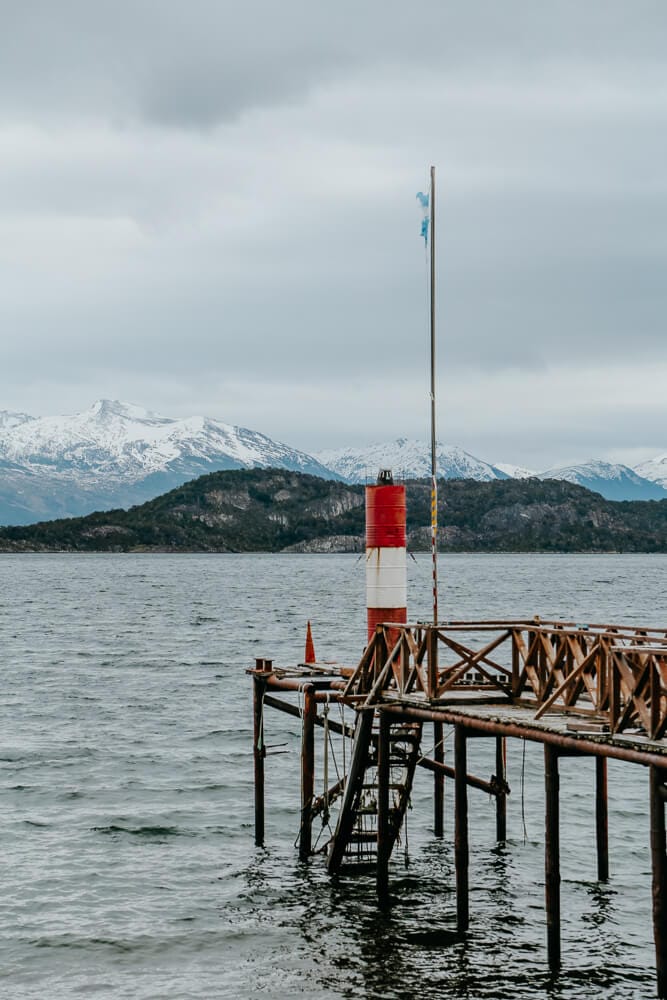
The stretch of Ruta 3 from the Alakush Visitor Center to the literal end of the road is dotted with easy trails and viewpoints.
You can easily kill a beautiful afternoon picking and choosing from these short trails. It really is a gorgeous region of the park.
With such easy trails you’ll be hard-pressed to find a better effort/reward value of stunning views anywhere.
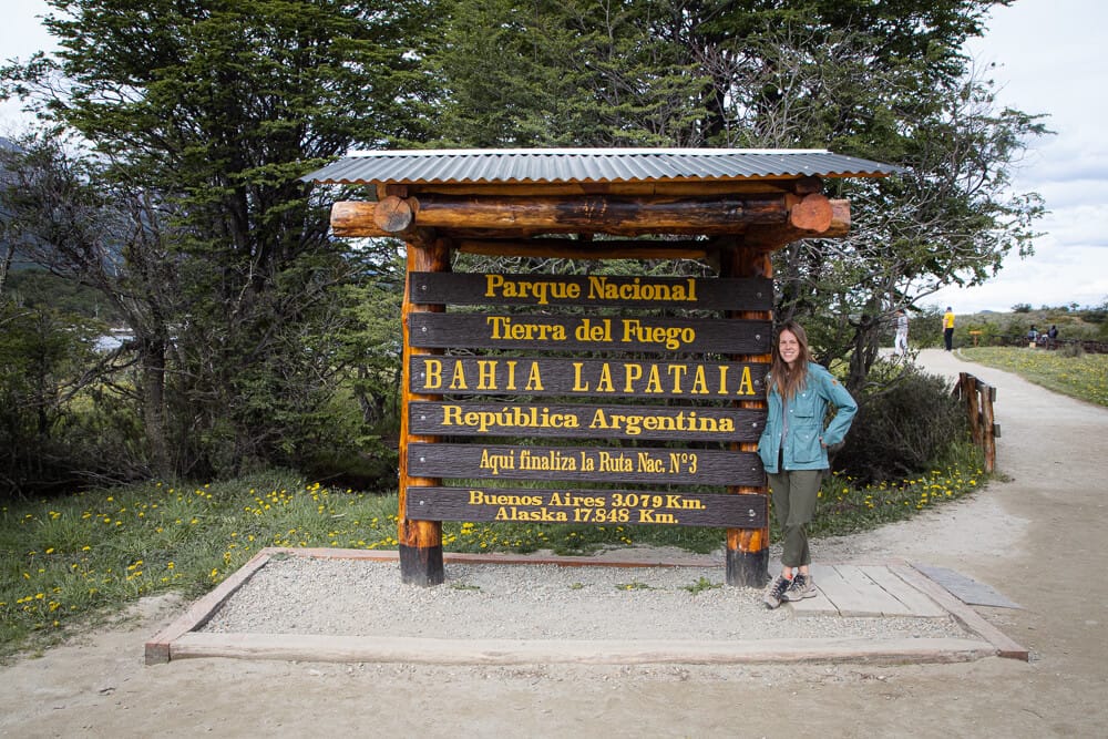
At the end of Ruta 3 take a picture with the sign commemorating the moment, marking the distance from Buenos Aires and even further, Alaska.
Hiking in Tierra del Fuego National Park
The best thing to do in most national parks is hike the beautiful trails and Tierra del Fuego is no different.
For a complete list of hikes here, read my post about the best hikes in Ushuaia (it includes the park and also the best trails outside the park).
Pack proper footwear as Tierra del Fuego is notoriously muddy, my hiking boots saved me.
If you have proper boots and hiking poles (I use this cheap beginner-friendly pair), bring them.
Wear layers. You cannot predict the weather this far south and the same summer day can be sunny and snowy.
Dress for all seasons in light layers you can peel off as needed.
Easy Trails
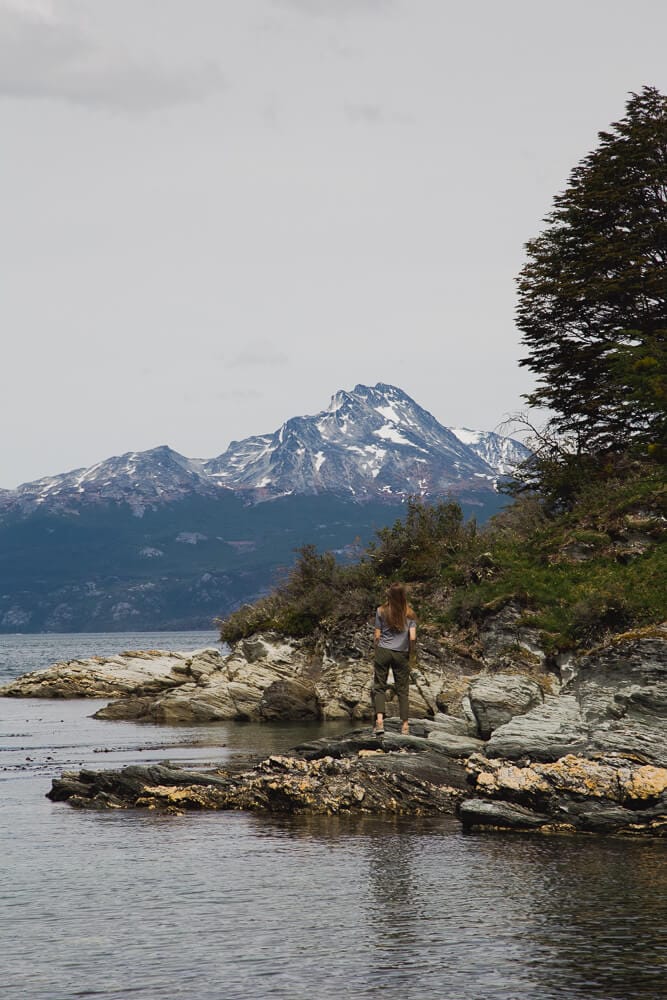
Towards the end of Ruta 3 in the Lapataia region, from the Alakush Visitor Center to the end of Ruta 3 (and the end of the park) there is a series of short, easy trails suitable for all ages.
They vary from 30 minutes to an hour, all are very easy in difficulty.
Get a map when you pay your entrance fee for a list of these trails and viewpoints (I also list them in this post).
They are all grouped one after the other towards the end of Ruta 3 and it’s easy to do one right after the other.
Of these trails, my favorite of these was Paseo de la Isla.
Moderate Trails
- The Senda Costera: This is the most popular hike in the entire park (and what I recommend if you only have time for one hike). It is 8 km one way and takes 2-3 hours (more if you stop for a picnic on the many rocky beaches).
- Pampa Alta: This hike starts near the Fin del Mundo Train station in the Río Pipo area and ends at the Bahia Ensenada and the Senda Costera trailhead (you could easily combine both to hike across the park).
- Hito XXIV: Hike to the border with Chile along the shore of Lago Acigami (formerly Lago Roca). This 7 km out and back (3 hours) trail is very easy for a moderate trail and doable on misty days as most of the hike is under cover of the forest.
Difficult Trails
For a difficult hike head to Cerro Guanaco.
It takes 4 hours or more and is 8 km out and back. The trailhead is the same as Hito XXIV at Lago Acigami past the Alakush Visitor Center.
The trail is a steep uphill schlepp for the entire ascent up Cerro Guanaco, rewarding you with panoramic views of the mountains and the Beagle Channel.
Part of the trail crosses peat bogs (turbera in Spanish) so definitely wear waterproof hiking boots and use hiking poles.
Much is also exposed to the regions infamous strong Patagonian wind so wear a windbreaker/raincoat.
How to Cross Tierra del Fuego National Park on Foot
No car and on a budget? No problem.
Many of the Ushuaia hikes in the park are one way and connect to each other, making it possible to traverse the park on foot.
Hire a taxi to drop you off at your starting point and have an arranged pick up time and place. Usually taxis pick passengers up at Bahia Lapataia at the end of the day.
If you want to hike and know you can handle a full day on your feet, this is a very fun option!
If you don’t think you can do a full day, perhaps set your sights lower and have them pick you up closer (like the Alakush Visitor Center). They could always drive you down to Lapataia Bay before leaving the park.
I mention that only because I picked up two exhausted middle aged hitchhikers who were too exhausted to hike the rest of the way to Lapataia to meet their taxi.
Cross the Park on Foot: The Route
- Start at Bahia Ensenada at the post office. Kick the day off by sending a postcard to your loved ones stamped from the end of the world if the post office is open (currently closed until further notice).
- Start your hike on the Senda Costera (8 km). The hike ends on the main road, Ruta 3. Walk down the road past the Alakush Visitor Center (and the only bathroom if you need it!).
- Keep on Ruta 3 and cross the small bridge to reach the Paseo de la Isla Trail (just over 1.3 km). This trail ends at the Laguna Verde Mirador/Viewpoint, stop, enjoy, take pictures, then…
- Continue on Ruta 3, option to hike out and back to Laguna Negra
- Take the Sendero del Turbal (2 km), this short hike across peat bogs joins…
- The Senda Castorera, a short boardwalk of a trail that highlights the effects of beavers on this habitat.
- Take Senda Castorera back to Ruta 3 and continue on the dirt road until you see the parking lot and signs for Bahia Lapataia, it’s a short walk. You’re almost there.
- From here there are a few short trails with views of the bay, like Senda La Baliza (1.5 km), great for birdwatching.
- OPTION TO EXTEND: If you want even more, start your day even earlier at Pampa Alta and hike to Bahia Ensenada to start the above route. Personally, I think this is too much but if you’re ambitious… it’s possible.
Argentina Travel Resources
- BOOK A CONSULTATION | I offer one-on-one travel consultations to help you plan your trip to Argentina. Pick my brain to get a local’s insight. Click here for more information.
- MY MAP | Buy my interactive map with 300+ pins to have access to the city as I see it. It is an invaluable resource. See more here about how it works.
- AIRPORT TRANSFERS | Having a driver waiting for you is ideal for a stress free arrival, Welcome Pickups is the best option for a driver from Ezeiza or Aeroparque.
- TRAVEL INSURANCE | Always travel insured. Anything can happen anywhere and it is scarier and costlier in an unfamiliar country. SafetyWing’s Essential Plan covers unexpected travel and medical emergencies and even offers add-ons like electronics theft or adventure sports. It is the best if you’re coming on vacation. If you’re coming as a digital nomad or an extended stay, you need their Complete Nomad Plan which also covers routine check ups, maternity, mental healthcare and more. Read more: Health Insurance in Argentina
- PHONE PLAN | These days, traveling with data is essential. Especially in Argentina where everything is managed on Instagram and WhatsApp. I recommend this E-SIM card. It’s hassle-free and affordable, for more read how to get an Argentina sim card.
- ACCOMMODATION IN ARGENTINA | booking.com is the most common hotel site used in Argentina and it’s where you’ll find the most options.
- RENTAL CARS | I love to travel Argentina via road trip, Discover Cars is a great platform to compare different rates and providers.
- BUS TICKETS | Check Busbud for long distance bus routes and tickets.
- VPN | If you’ll be using a public WiFi connection and want to secure your data, I highly recommend using a VPN, I personally use and have had a good experience with ExpressVPN. I also use it to access Hulu and American Netflix from Argentina.
- FLIGHTS | Always check Google Flights and Skyscanner for flights to and within Argentina. Aerolineas Argentina is the local airline with the most routes. FlyBondi and Jetsmart are two budget airlines with dirt-cheap prices (but expect to pay for every add-on like luggage).
Read More About Ushuaia
To keep planning your time in Ushuaia and Patagonia, read my other guides:
- The Best Things to do in Ushuaia + Travel Guide
- Trekking Ushuaia: The Best Trails
- Things to do in El Calafate
- How to visit Perito Moreno Glacier
- The Best Hikes in El Chalten
- Things to do in Puerto Madryn
Pin It For Later


Hi! Trying to make sense of all of the trails and your blog has given me sooooo so much helpful insight. Some questions!
From Senda Castorera to Ruta 3 and then onto Bahia Lapataia – that’s where the sign is at the end of the road, right? And then I would head back to the visitor’s center just along Ruta 3?
How long is the Pampa Alta hike…I’m considering taking the train into the park but am trying to figure out if I can actually explore the park as I’d like to from the train. If I’m a slow but steady hiker (not good with elevation but a reasonably good hiker and walker), could I do the train, then hike down to the Coastal Trail, then end at the visitor center, or would that be pushing it?
Doing the Pampa Alta hike one way is about 4 km give or take, you could easily do that hike to Senda Costera, then stop by the visitor’s center. I don’t think you’d be pushing it at all. Ruta 3 ends at Bahia Lapataia, it might be a bit long to do it all but if you start early and love hiking it is totally doable. I’d have a hired car arranged to bring you home from the end of Ruta 3, you can hire taxis to be waiting for you at a set time so you don’t have to hoof it back out after already hiking ALL day
Hi – Do you know if the park will be open on New Year’s Day? Thanks!
According to this they’re open every day, including holidays:
https://www.argentina.gob.ar/parquesnacionales/patagonia-austral/parque-nacional-tierra-del-fuego/horarios-como-llegar
Hi,
We are going to the park in February 2025 – do you know if we have to buy entrance tickets in advance – or can we just grab a taxi – and buy the entrance tickets at the entrace?
Thanks a lot!
Best regards Bente
You can buy them in person