
⚠︎ 2025 Wildfire Update: As of February 12, El Bolson is suffering major wildfires that is reaping irreparable damage on its forests. All trails in the ANPRALE protected area (the refugios) are CLOSED until further notice. The damage is immense, do not anticipate a prompt re-opening. Click here to donate to help firefighters and eventual rebuilding.
El Chalten may be the hiking capital of Argentina, but El Bolson is right on its heels.
What distinguishes Northern Patagonia’s hiking from El Chalten is its system of refugios, or mountain huts.
When the Germans settled in Bariloche they brought their mountaineering culture with them, including a system of huts in the mountains where hikers can stay overnight with a bed and hot meal.
El Bolson, just two hours south of Bariloche, also has its own network of refugios.
In fact, it has the largest system of interconnected refugios in South America.
Plan your hike right and you could spend a few days in the mountains without ever needing to return to the city.
Just want to hike for the day?
There are a number of popular day hikes in El Bolson of varying length and difficulty as well.
El Bolson truly is a hiker’s paradise.
Warning: this guide to trekking El Bolson is fairly detailed and logistical. It’s not an anecdotal write up of my hikes, but an informational guide. I hope it helps you!
QUICK NOTE: This post contains affiliate links and Sol Salute may receive a commission for purchases made through these links, at no extra cost to you.
A Hiker’s Guide to Trekking in El Bolson
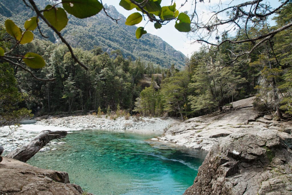
El Bolson is a hiker’s paradise, but it’s not as easy to navigate as hiking in El Chalten.
In El Chalten, just about all of the trailheads are on the edge of town, making it very easy to just show up and explore right from your hostel’s door.
The trails in El Bolson are scattered about, so you’ll need to decide where you want to hike and how to get to there.
I’ll divide this post by area to make it easier to plan.
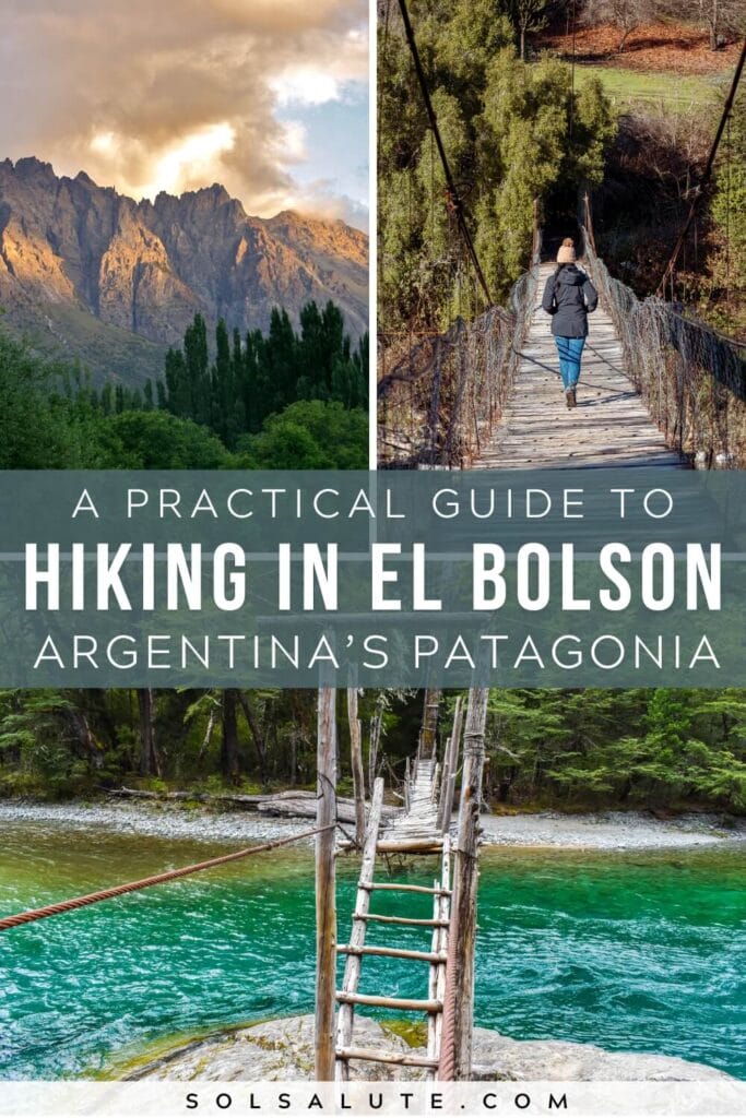
Trekking El Bolson’s Refugios
El Bolson is home to the largest network of interconnected mountain huts (or refugios) in all of South America.
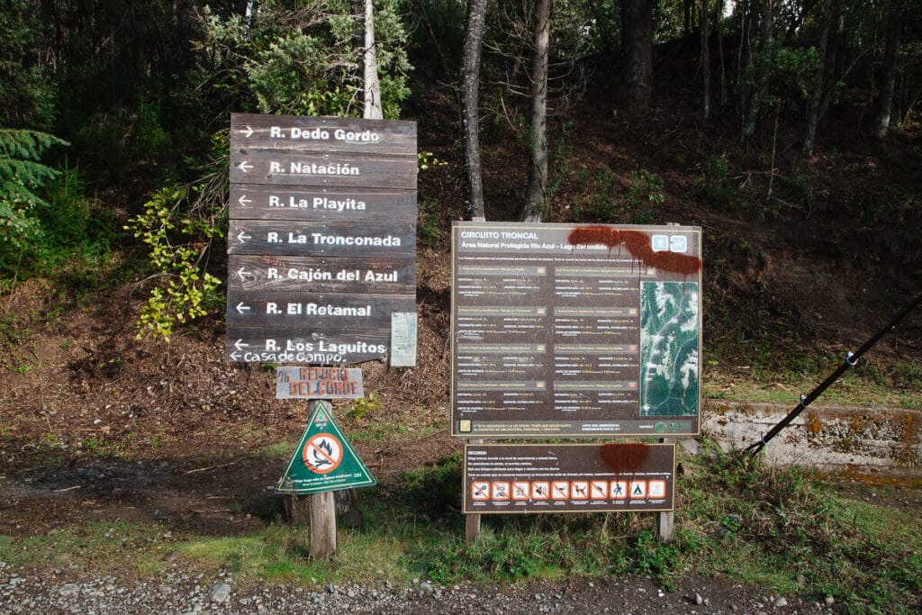
The protected area (not national park but let’s treat it like one) outside of El Bolson is called the Área Natural Protegida Rio Azul-Lago Escondido.
You will see signs for ANPRALE everywhere, that is what they’re referring to.
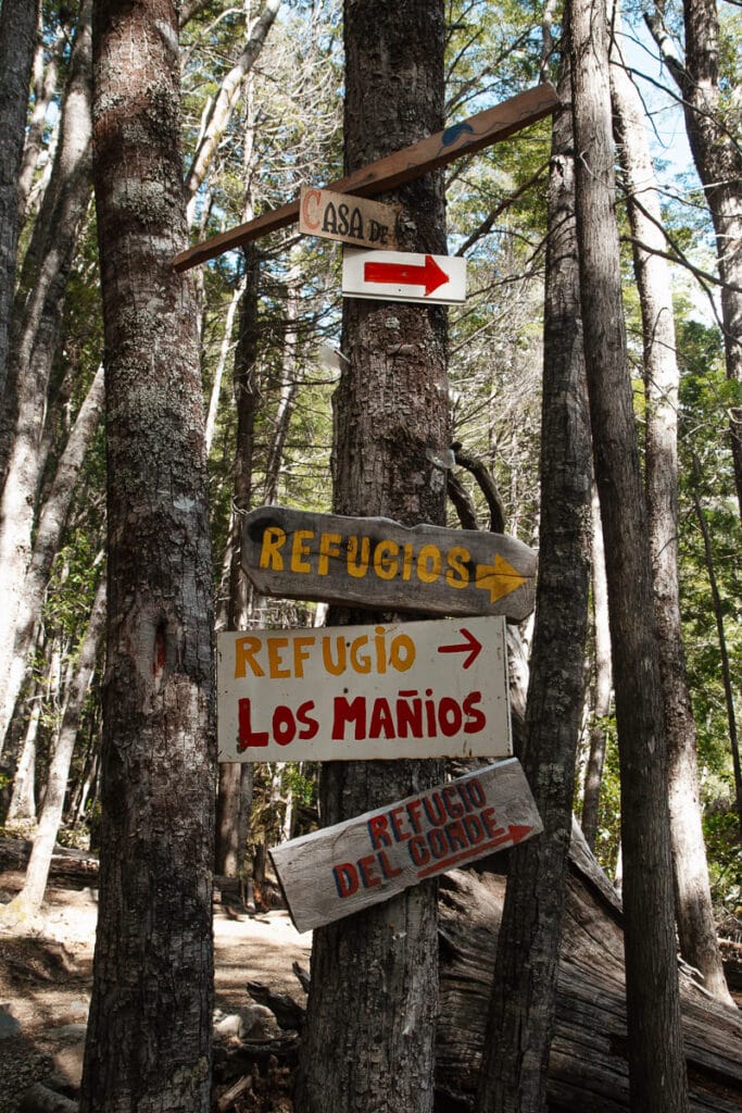
Within ANPRALE there are 13 refugios and you can really create your own adventure by how you decide to connect them.
From a simple day hike to a challenging multi-day trek, there are a lot of options on how to create your perfect route.
I recommend visiting the Oficina de Informes de Montaña in advance of your hike.
They will help you figure out a route as well as advise you on what you need re: equipment, registration etc. for those specific trails.
The Mountaineering Information Office is open 7 days a week from 8 am until 9 pm, but when we were there in October they were never open (likely it was too early in the season).
If you do find them closed, just turn the corner to the regular Tourist Information office, they helped me with a few questions about my day hike to Cajon del Azul.
Both offices are in the same building (different doors) right on the main square by the feria.
⚠️Important – Hike Registration: You need to register for your ANPRALE hike in advance, do this here online (in English & Spanish). You will be required to show your confirmation to a park ranger, have it available.

Resources
I can’t begin to tell you all of your options here because there are really SO many.
Here are a few suggestions and tips, as well as links to helpful resources.
- Downloadable PDF Map – First, download the map and try not to get overwhelmed by all the information that you see. It is very helpful, showing the refugios and their possible circuits, with the distances between each one.
- El Bolson Tourist Information – The official tourism board has a detailed description of the refugios and the route, it’s in Spanish but you can roll the dice with Google Translate. Use it with the map open to get a complete idea.
- Best Day Hike – Cajon del Azul – Shut up, all of this is too confusing, I just want to do one day hike, where do I go? Cajon del Azul is the most popular trail (with the caveat that it is insanely busy in summer, keep reading for alternatives). It will take a full day, calculate 3 hours each way with time to enjoy there in between. Coming soon, a detailed review of my day hike to Cajon del Azul.
- List of Refugios – This helpful article lists the refugios along with amenities and services available at each one.
Summer at Cajon del Azul & When to hike to El Bolson’s Refugios?
While yes, summer is the best time to hike for the warmth and longer daylight hours, it will also be the most crowded.
From the holiday season through February you can expect massive crowds to popular trails like Cajon del Azul.
Summer crowds involve waits of up to an hour or more just to show your registration at the start of the trail and long bottlenecks to cross the footbridges over the river.
And most important to note, the crowds on the trail at Cajon del Azul create the vibe of a party hostel.
Imagine groups of hikers with music blaring on their speakers and partying along the way.
This isn’t the environment I’m looking for when I go for a hike in the mountains so if that’s also how you feel, consider alternative trails in the summer.
Encanto Blanco, Motoco, and Cerro Lindo, for example, can be much more peaceful experiences in the summer.
Natacion is also a great option since you can use the trail head in Dona Rosa to skip the massive crowds going to Cajon del Azul.
In the fall head to Dedo Gordo, you’ll feel like you’re in a fairy tail hiking through mushroom filled forests tinted red with the lenga forest’s fall foliage.
Overall, the takeaway is that mid-season – late spring and early fall – is ideal to avoid crowds and to enjoy spring blooms or fall foliage.

How to get to the Trailheads
The most popular hikes start at Chacra Wharton, talk to any backpacker or hiker in El Bolson and you’ll hear the name Wharton pop up a lot.
It is 20 minutes from downtown El Bolson.
The easiest way to get there is with your own car (or by hiring a remis/taxi), check rental rates here because I love having the freedom of a car in this area. Chacra Wharton offers paid parking.
For those on a budget there is a bus by Transporte Golondrina that leaves Plaza Pagano at 8 am and gets you to Wharton by 8:30.
To return, the bus leaves Wharton at around 5:15 pm and 7:45 pm.
Alternatively, you can try your hand at hitchhiking.
I threw my thumb out while I waited for the bus home and to the chagrin of all my fellow hikers waiting for the bus, I immediately caught a ride to town.
The hike to Encanto Blanco starts further up the road past Wharton. The same rules apply: car/remis, the same bus, or hitch a ride.
Other trailheads – There are alternative routes, for example from Camping Doña Rosa, but to keep things simple I’m not going into them here. You’ll most likely be hiking from Chacra Wharton.
For more information or options, ask the professionals at the mountaineering information office in town.
⚠️ Cell Service: Understandably, there is no cell service at the trailheads in Wharton or on the trail. The park ranger said they have WiFi at the trailhead, ask her for the password if she’s there in the morning because if you return late hoping for WiFi to call a ride home, she’ll be gone and you’ll be out of luck (speaking from experience). That said, even if they “have WiFi” it is highly likely it may not work up here.
Bosque Tallado & Cerro Piltriquitrón
Leaving behind Wharton and its refugios, head to Cerro Piltriquitrón, the iconic mountain that towers over El Bolson.
At the top of Piltriquitrón is another of El Bolson’s classic refugios: the aptly named Refugio Piltriquitrón.
Luckily, the trail is fairly easy and short.
Taking Ruta 40 south towards Epuyen and El Hoyo you’ll see the access road to Piltriquitrón on your left.
After just over 10 kilometers of winding switchbacks up the mountain you’ll reach “La Plataforma” viewpoint and parking lot.
No car? You can walk up from Ruta 40 but you’ll be walking 10 kilometers up the mountain, turning an enjoyable hike into a hard slog (my personal opinion).
From the Plataforma, you’ll walk 1 kilometer straight uphill to the Bosque Tallado, a must-see in El Bolson.
After El Bosque Tallado you’ll see the trailhead continue up the mountain to reach the refugio.
In total, it takes 1-2 hours to reach the Refugio from the Plataforma.
The views from the Refugio are spectacular but you can continue another 45 minutes from here to the mirador at the top of Piltriquitrón.
This is an easy (“easy” as it is short but very steep) day hike offering high reward views.
Leave early enough in the day to be able to enjoy a picnic lunch at the Refugio, a long wander through the Bosque Tallado, and the time to hike to the very top.
Stay overnight at Refugio Piltriquitrón: If you want to stay the night here, reserve in advance at the Oficina de Informes de Montaña in town as space is limited. Click for more information.
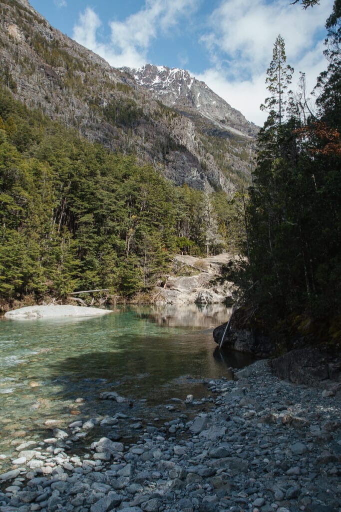
El Rio Azul & El Paraiso
How does low effort/high reward sound?
I thought so.
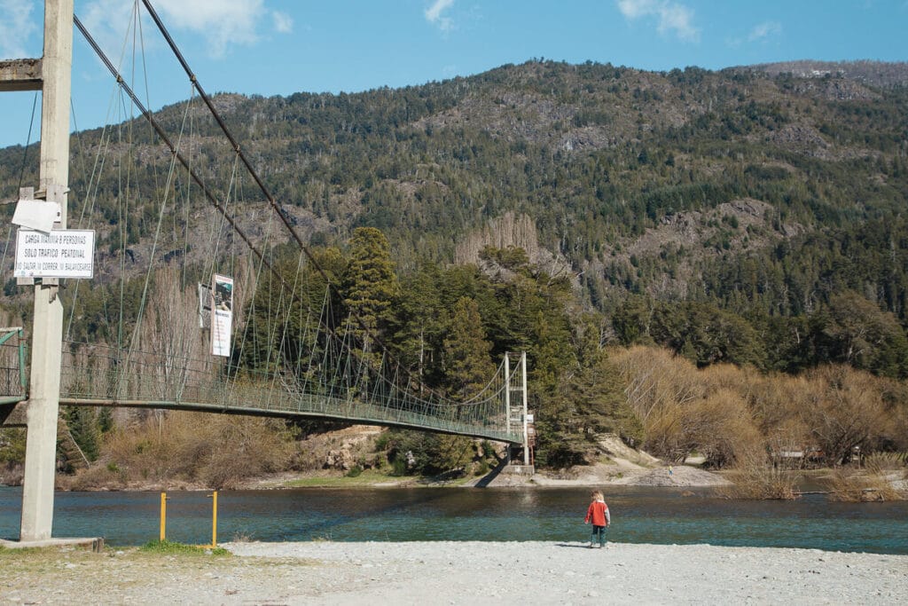
Head to the Doña Rosa campgrounds (you can find camping Doña Rosa in Google Maps) on the shores of El Rio Azul.
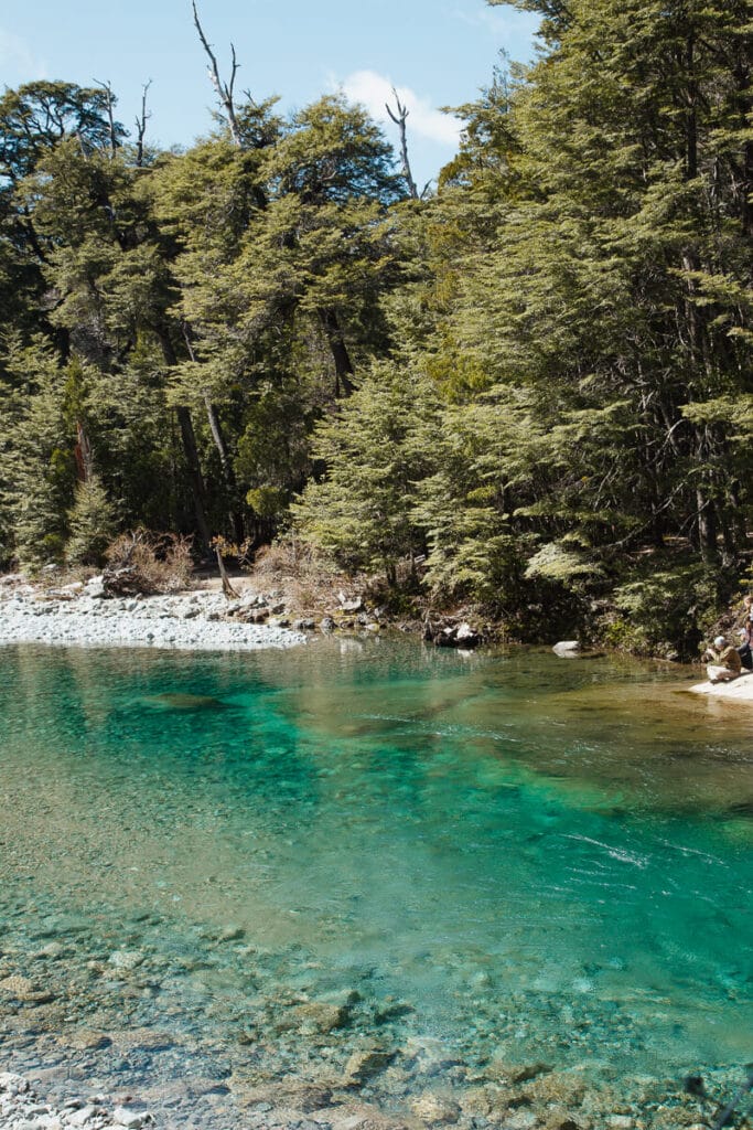
From here you can cross the hanging bridge (pasarela) and turn right to walk along the river for about thirty minutes to reach the pozones (like a swimming hole in the river) called El Paraiso.
It’s described by locals at Cajon del Azul without the effort.
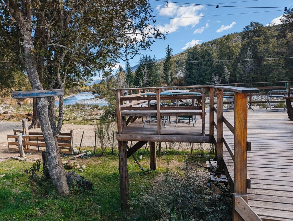
You can and should also grab a beer or lunch at Campo Base, about 100 meters from the hanging bridge.
There isn’t much sun late in the day at the pozones as the high mountain walls block it out, ideal on hot day but still pack sunscreen and plenty of water.
There are a few different campgrounds right here on the shore of the river, like Campo Base. If you have your tent and want to camp out, this is a great spot!
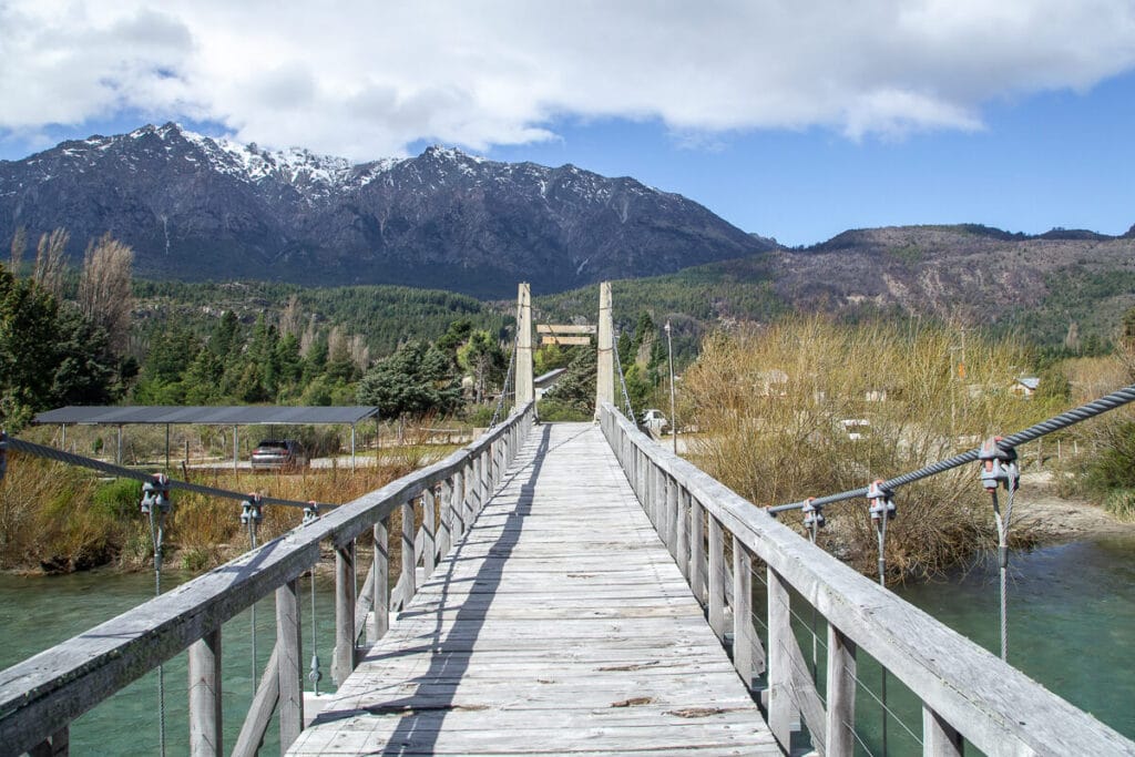
More Pasarelas & Short Hikes
Throughout El Bolson’s surroundings you’ll find a lot of hanging footbridges/pasarelas like El Paraiso described above.
They all feature short trails that are great options if you’re looking for an easier hike.
Put the names below into Google Maps to find the following lower effort trails:
- Pasarela Rio Azul – Just outside of Lago Puelo, from here you can hike to a small waterfall, la Cascada Motoco Cardenas. There is also a small campground with a restaurant and facilities open during the summer season.
- Pasarela La Confluencia – Also just outside of Lago Puelo, this pasarela is right after the confluence two rivers. Cross the bridge for a rewarding hike.
- Las Pataguas – This pasarela is further south, almost to Epuyen. There is a beautiful hosteria here where you can book a room. It’s private property but the footbridge, it’s parking lot and the trail are freely accessible to the public.
What to bring on your El Bolson Hike
The trails to the refugios are unlike any other hike I’ve ever been on.
It feels almost like a hidden away city in the wilderness.
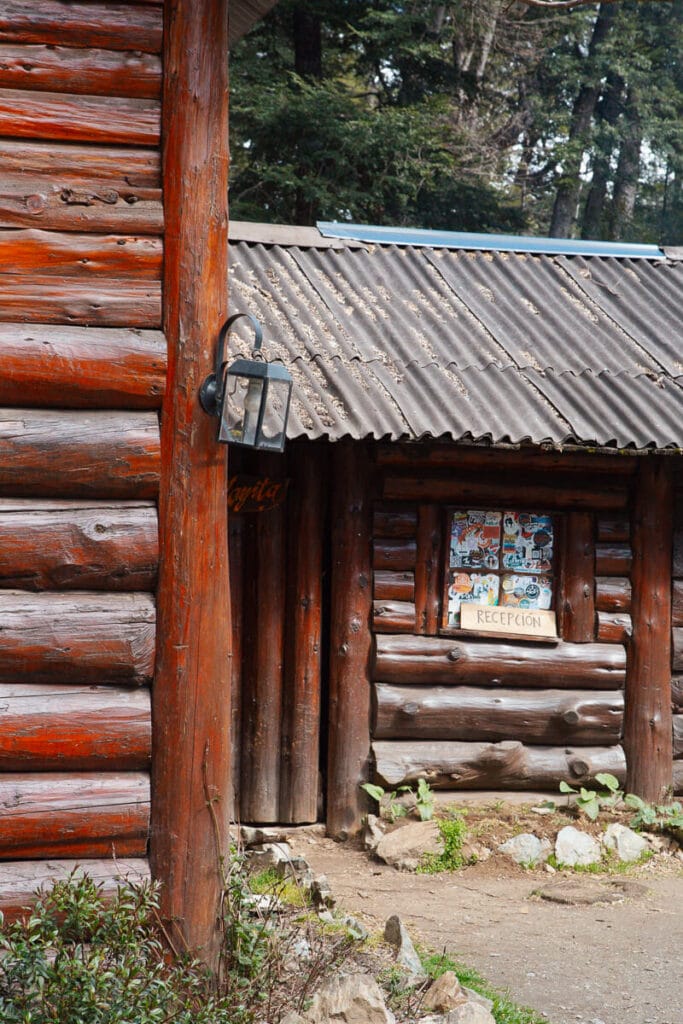
There are little stands selling drinks and snacks along the way and you can pick up food and drinks in the refugios.
It’s still ideal to pack a picnic with all the snacks and plenty of water, but you won’t be as isolated as you as you’re used to on the average mountain trail.
For example, going to Cajon del Azul, I stopped at Refugio La Playita for a torta frita and fellow hikers were already indulging in a beer.
More prudent trekkers were filling up their thermos’ with hot water for their yerba mate.
There was even a little restaurant booth set up at Bosque El Tallado.
For meals you can get things like a pizza, sandwich, etc. I brought empanadas from town and a lot of chocolate, as things will be a bit pricier at the refugios considering how far those snacks have to travel to get there.
Other than food, bring the usual suspects: sunscreen, a hat for more sun protection, plenty of water for the day, and your camera.
Read More
- Things to do in El Bolson: Patagonia’s Hippie Mountain Paradise
- The 14 Best Hikes in Argentina
- The Cities of Argentina’s Lake District in Northern Patagonia
- Things to do in Bariloche: A Complete Travel Guide
- Trekking Ushuaia: A Guide to Hiking in Ushuaia
Argentina Travel Resources
- BOOK A CONSULTATION | I offer one-on-one travel consultations to help you plan your trip to Argentina. Pick my brain to get a local’s insight. Click here for more information.
- ☕BUY ME A COFFEE | If you’ve enjoyed my blog and found it useful, you can buy me “virtual” coffee.
- MY MAP | Buy my interactive map with 300+ pins to have access to the city as I see it. It is an invaluable resource. See more here about how it works.
- AIRPORT TRANSFERS | Having a driver waiting for you is ideal for a stress free arrival, Cesar and his team here is the best option for a driver from Ezeiza or Aeroparque, they are my go-to airport ride!
- TRAVEL INSURANCE | Always travel insured. Anything can happen anywhere and it is scarier and costlier in an unfamiliar country. SafetyWing’s Essential Plan covers unexpected travel and medical emergencies and even offers add-ons like electronics theft or adventure sports. It is the best if you’re coming on vacation. If you’re coming as a digital nomad or an extended stay, you need their Complete Nomad Plan which also covers routine check ups, maternity, mental healthcare and more. Read more: Health Insurance in Argentina
- PHONE PLAN | These days, traveling with data is essential. Especially in Argentina where everything is managed on Instagram and WhatsApp. I recommend this E-SIM card. It’s hassle-free and affordable, for more read how to get an Argentina sim card.
- ACCOMMODATION IN ARGENTINA | booking.com is the most common hotel site used in Argentina and it’s where you’ll find the most options.
- RENTAL CARS | I love using Discover Cars, it is a great platform to compare different rates and providers and I find they have responsive customer service.
- BUS TICKETS | Check Busbud for long distance bus routes and tickets.
- VPN | If you’ll be using a public WiFi connection and want to secure your data, I highly recommend using a VPN, I personally use and have had a good experience with ExpressVPN. I also use it to access Hulu and American Netflix from Argentina.
- FLIGHTS | Always check Google Flights and Skyscanner for flights to and within Argentina. Aerolineas Argentina is the local airline with the most routes. FlyBondi and Jetsmart are two budget airlines with dirt-cheap prices (but expect to pay for every add-on like luggage).
