
If you are landing on this Bariloche hiking guide, I’m glad you’re here and hope this helps you explore one of my favorite places on earth.
My name is Leslie Holgate. I called Bariloche home for 9 years.
During that time and in all four seasons, I hiked solo, with friends, with my family, and on guided group treks.
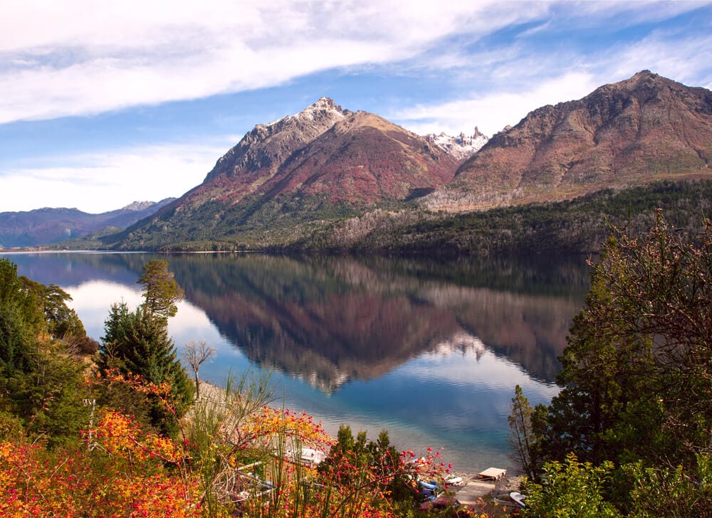
Argentina’s Patagonia is a hiker’s dream, from the National Capital of Trekking in El Chalten to the end of the world in Ushuaia, and from El Bolson to Bariloche in the lake district.
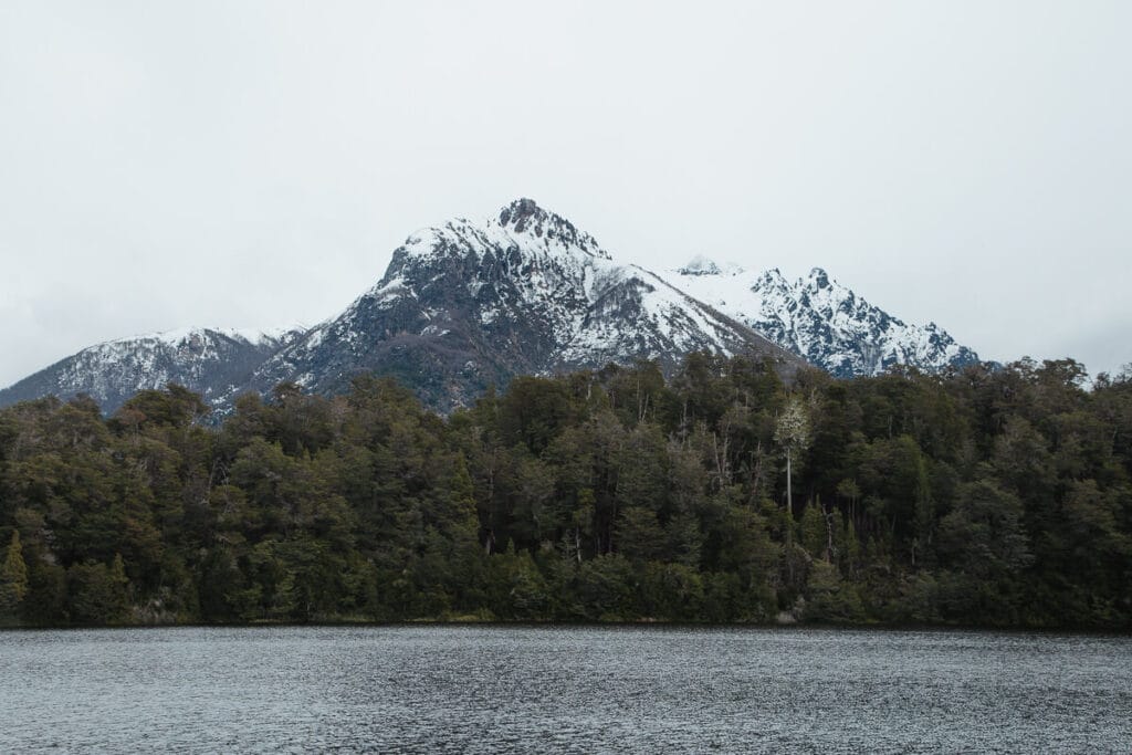
Bariloche lies on the shores of Lake Nahuel Huapi, surrounded by Argentina’s oldest national park of the same name.
Nahuel Huapi National Park is home to an impressive network of trails for half or full-day hikes, as well as interconnected mountain huts (or refugios), ideal for multi-day adventures.
The national park is massive, measuring more than 2,700 square miles, spanning across both Neuquén and Río Negro provinces. It encompasses Bariloche – the gateway town to the park.
Take one look at the views, and you’ll see why this is one of Argentina’s most popular destinations.

QUICK NOTE: This post contains affiliate links and Sol Salute may receive a commission for purchases made through these links, at no extra cost to you.
A Complete Guide to the Best Bariloche Hikes
The diversity in Bariloche’s hiking is unparalleled.
To help organize the dizzying number of options, I’ve broken this guide up into 3 main categories and given 2 other important categories their own dedicated guides:
- Llao Llao Municipal Park: This is your spot for easy to access family-friendly trails and beautiful scenery in shorter distances within the Circuito Chico route.
- Villa Los Coihues, Lago Gutierrez: A well-marked trailhead for three trails leading to a waterfall (Cascada de los Duendes), a viewpoint (Mirador Lago Gutierrez), and a beach (Playa Muñoz).
- The 4 Refugios: Bariloche’s refugios are epic that they deserve their own guide: All about the refugios in Bariloche.
- Pampa Linda, Cerro Tronador: Like the 4 refugios, there is so much to write about Pampa Linda that it also earned its own post, read it here.
- Specialty Hikes Near Bariloche: This category features two unique hikes as day trips from Bariloche, from out-of-this-world rock formations to a heart-shaped island.

Hiking in Bariloche: Know before you go
Before you hit the trail, here’s a list of essentials to know.
- When to hike in Bariloche: The best time is from December to March, during the summer season. Many refugios are open beyond these months, but conditions become less predictable, varying from year-to-year depending on snow and ice.
- Weather Closures: Alerts are issued for weather, such as strong wind. (One word I’ll never forget from living in Bariloche is “rafaga” for wind gusts.) Trail closures for safety are announced by the national park here. These are good days to visit one of the local tea houses or cafes.
- Do I need a guide for any of these hikes? Going with a certified guide is often recommended and can dramatically improve the overall experience on certain hikes. I went with a guide on the refugio traverses and on snowshoeing excursions, because I wanted the additional expertise and support. A lot of it comes down to knowing your experience level and comfort.
- Refugio Reservations: Advance reservations are required to sleep in or camp at any of the refugios. Save a copy of your reservation to show on arrival (print or digital). Check the rates before you go, to plan for cash-only payments. More information in the refugio guide.
- Visit Bariloche Trekking: One of the best overall resources of information with downloadable maps, helpful tips, and directions here.

How to get to the best Bariloche Hikes
All of these Bariloche hikes are in different areas, in different parks and on different lakes. Luckily, it’s easy to get around.
Here is how to reach your trailhead:
- Bus: Many of the top hikes can be easily reached by public transportation. You can buy a SUBE pass at kiosks in town. The most common routes are the 20 (to Llao Llao), the 55 (to Cerro Catedral), and the 50 (to Villa Los Coihues).
- Taxi, Remis, or Car Rental: If you’re with a group or want to be on your own schedule, it may be easier to share a remis/taxi or to rent a car for flexibility. Check rental car availability.
- Hitchhiking: This practice is common in Patagonia. Many hikers often go to a bus stop, and take whichever comes first: the bus or a friendly ride. I picked up many hikers when coming back from places like Colonia Suiza, where the buses can get packed.
- Mix/Match: Even though I had my own vehicle in Bariloche, I would often take a taxi/remis to a refugio trailhead to avoid leaving my car overnight. Then I’d catch the bus home on return when I was in no hurry.
- Pampa Linda, Tronador Shuttles: Tour vans and buses depart daily from outside Club Andino (advance reservation required).

1. Easy Bariloche Hikes in Parque Municipal Llao Llao
This network of trails is easily accessed from the scenic Circuito Chico route, a short distance from Puerto Pañuelo and the Llao Llao Hotel.
These Bariloche hikes are ideal for walking with family and friends.
Llao Llao is one of the most visited areas, so get an early start for the most peaceful experience.
Check the weather forecast and national park alerts for trail closures in the event of strong winds and unsafe conditions.
If you want a guide to organize an entire day in the Circuito Chico with all the sites plus hikes, book this excursion.
☕Tip: Start or end with a coffee from Llao Cafe del Bosque Coffee Truck. The friendly owners have coffee, hot chocolate, treats, and maps to help you enjoy the park.
Note: I’m including a description for each of the hikes individually and a route at the end if you want to make a day of it by combining them all into one awesome trek.
⚠️Llao Llao Municipal Park Registration & Entrance Fee: These trails require their own registration and payment (exceptions for Bariloche residents, kids under 12, and retirees). You can pay beforehand online here OR the main points of entry have a sign with a QR code where you can scan and pay. As of the 2024/2025 trekking season, the fee is $1155.


Brazo Tristeza
Distance: 2.5 miles roundtrip
Time: 90 minutes
Difficulty: Easy
Registration/payment
How to Get There: Access by car or bus #10. Trailhead is by the parking area at Bahia López, next to the Alun Nehuen Hotel.
This is the best high reward, minimal effort Circuito Chico hike.
You will walk through the forest for roughly 40 minutes before coming to an open, rocky outcrop.
Take in the stunning scenery overlooking Brazo Tristeza of Lake Nahuel Huapi and facing Cerro Capilla. If you’re lucky, a condor may soar overhead and a boat will cruise by below.
Bosque de Arrayanes & Lago Moreno
Distance: 3.75 miles roundtrip
Time: 2 hours
Difficulty: Easy
Registration/payment
How to Get There: Access by car or bus #20. Continue about a half mile past Puerto Pañuelo to a parking area and trailhead.
Here you will wander a nature trail with informative signs that highlight plants and trees along the way.
After about 15 minutes, you’ll reach a wooden boardwalk for the Arrayan forest. The burnt orange trees, with twisted knobby formations, line the pathway.
Continue on the trail where the trees seemingly touch the sky, then take a brief side path to Lake Moreno beach where you’ll see a view of Llao Llao Hotel.
Returning back on the main trail, the next stop is Lake Moreno viewpoint. There’s a carved wooden table and chairs looking out at the lake and mountains.
Take a rest at this perfect picnic spot, before returning the way you came.
Cerro Llao Llao
Distance: 4 miles roundtrip
Time: 2 hours
Difficulty: Easy
Registration/payment
How to Get There: Access by car or bus #20 to Llao Llao. Go about a half mile past Puerto Pañuelo to a parking area and continue on the road an additional 300 meters to the Cerro Llao Llao & Villa Tacul trailhead.
This classic Bariloche trek is well-marked and is mostly a light walk, until you reach a junction after one mile – turn left to Cerro Llao Llao or turn right to Villa Tacul.
Turn left, from here the hike gains elevation.
Along the next mile, you’ll start to see glimpses of Lake Nahuel Huapi glistening through the trees to keep you going.
Reach the peak at Cerro Llao Llao, the highest point in Llao Llao Municipal Park at 3,350 feet.
Take a well-earned snack and hydration break, with impressive mountain scenery and Lake Moreno and Lake Nahuel Huapi below.
Return the way you came or extend the hike by continuing on to Villa Tacul.
Puente Romano & Bahia Tacul
Distance: 4 miles roundtrip
Time: 90 minutes
Difficulty: Easy
Registration/payment
How to Get There: Access by car or bus #20 to Llao Llao. Continue along the Circuito Chico road approximately 2.5 miles past Puerto Pañuelo to a parking area across from the Park Rangers home. This is the trailhead for hikes to Puente Romano, Mirador Tacul, Lago Escondido, and Bahia de Los Troncos.
On this mostly flat walk, take an immediate right after the trailhead. The trail will cross over the historic Roman Bridge.
Built in 1937, the “Puente Romano” was inspired from the ancient bridges of Rome. Among the forest scenery, the large stone structure feels like stumbling upon ruins with moss and plants intermixed.
Continue on to see the Tacul viewpoint, and in an additional 1.5 miles, pass by Villa Tacul and arrive to one of the most beautiful beaches at Tacul Bay.

Lago Escondido & Bahía de los Troncos
Distance: 2 miles roundtrip
Time: 1 hour
Difficulty: Easy
Registration/payment
How to Get There: Access by car or bus #20 to Llao Llao. Continue along the Circuito Chico road approximately 2.5 miles past Puerto Pañuelo to a parking area across from the Park Rangers home. This is the trailhead for hikes to Puente Romano, Mirador Tacul, Lago Escondido, and Bahia de Los Troncos.
One of the most fun and easy walks for families, plus it ends at a beach with plenty of logs or “troncos” making a natural playground.
This is the same trailhead as the previous hike, but here you’ll instead take an immediate left and walk a half mile.
You’ll see a wooden pier with a view of “Lago Escondido.”
In another half mile, arrive to your final stop at “Bahía de Los Troncos.” We had many afternoons where this hike was our entire day with a picnic and playtime at the beach.
Cementerio del Montañes
Distance: 300 meters
Time: 15 minutes
Difficulty: Easy
Registration/payment
How to Get There: Access by car or bus #10. The cemetery entrance is on the circuito chico route, roughly a half-mile from the Brazo Tristeza hike.
Visit the cemetery on a day when you’re already hiking in the park. This unique cemetery pays homage to some of the most beloved and important mountain figures of the area.
Follow the dirt and rocky path that lies on the slope of Cerro Lopez.
Pay tribute to those who loved mountaineering in their resting place. Club Andino holds a ceremony here each year on August 5, for “día del montañés” or “Mountaineer’s Day.”
Full-Day Circuit of Llao Llao Municipal Park
Distance: 15 miles
Time: 8 hours
Difficulty: Moderate due to distance
Registration/payment
How to Get There: Begin at the trailhead of Cerro Llao Llao, accessible by car or bus #20.
It’s possible to do the entire route in a day, if you have the stamina (and plenty of snacks and water).
The route includes some sections on the road to connect the trails.
Get an early start, beginning at the trailhead for Cerro Llao Llao and follow this order:
- Cerro Llao Llao to Villa Tacul
- Bahia Tacul & Puente Romano
- Lago Escondido & Bahia de Los Troncos
- Road section: Walk on the Circuito Chico route, crossing a scenic bridge called “Puente Arroyo La Angostura” and step out onto wooden platforms for Bahia Lopez and Cerro Capilla viewpoints
- Brazo Tristeza
- Cementerio del Montañés
- Road section: Return walk on road until reaching the Arrayan Trail (start at the end of the trail, going in reverse)
- Bosque de Los Arrayanes & Lago Moreno

Cerro Campanario
One of the best 360-degree panoramic views is from Cerro Campanario. This isn’t within the Llao Llao Municipal Park so it doesn’t not require any registration.
The view from the chairlift is stunning the entire way, but comes with a ticket cost.
If you’re on a budget, the hike is free. It’s short and steep, hidden in the trees, until you reach the top.
I did this 45-minute climb regularly for a morning exercise, but took visitors on the relaxed, more scenic lift.
Before 2025, I said, “Save your legs and take the chairlift.” Now, I might say, “Save money and hike.” However you get there, enjoy the view.
2. Villa Los Coihues, Lago Gutierrez
In this mountain community of Bariloche, you can explore easy Bariloche hikes and beautiful beaches by Lago Gutierriez.
From one main trailhead, there are three hikes leading to a waterfall, a viewpoint, and a beach.
⏰This area gets especially busy in the summer and is accessed by a dirt road. Arrive early to find parking and beat the crowds.
🚗How to get to Lago Gutierrez | The 3 hikes below all depart from the same trailhead. Get there by taking bus #50 to Villa Los Coihues or by car where you’ll park next to the Lago Gutierrez park ranger station.
☕Tip: If going by car, stop for some of the best medialunas at Kanay (a pick-up window bakery nearby in Villa Lago Gutierrez). Plan to end your day with tea at No Me Olvides (reservation recommended).
Cascada De Los Duendes
Distance: 800 meters roundtrip
Time: 30 minutes
Difficulty: Easy
Registration needed: No
This is a well-marked and well-traveled path to a waterfall and an ideal walk with young children.
Combine it with another hike, a kayak excursion or a beach day. If you love waterfalls (which who doesn’t?), but want more distance, continue to the mirador/viewpoint.
Mirador Lago Gutierrez
Distance: 1.5 miles roundtrip
Time: 1 hour
Difficulty: Moderate
Registration needed: No
This hike begins on the same trail as the waterfall, but instead take a left turn at the sign toward “Mirador Lago Gutierrez.”
You’ll begin to climb in elevation and pass by another fork in the trail (which goes to Playa Muñoz). Continue to the right.
The last part is short, but steep. You’ll be rewarded with a panoramic view of Lago Gutierrez.
Playa Muñoz
Distance: 7 miles roundtrip
Time: 5 hours
Difficulty: Moderate
Registration needed: Yes, complete here and print or save confirmation to your phone. (I’ve seen park rangers monitoring at the fork in the trail, to make sure hikers headed to Playa Muñoz have completed their registration)
Who doesn’t love a hike that ends at a beach?
And the early bird gets the worm. I often ended up with a private beach by getting an early start (the theme for all hikes).
The first few hundred meters share the trail with the waterfall and the viewpoint hike.
The next few hours are on a relatively flat and sandy path, but with shade being elusive much of the time. On hot, summer days, we were happy to have extra water and a good sunhat.
The hike then returns to the forest until you emerge at a large beach area where you can jump right in to cool off. Return the way you came after a swim and picnic.

3. Bariloche Refugios
The four main refugios – Frey, Lopez, Jakob, & Laguna Negra – are among the most iconic hikes in Bariloche.
There is so much to know to plan your hikes there, that I decided to dedicate an entire guide just to them: All About the Refugios in Bariloche.
Whether you want to go on a day hike, stay overnight or to go on a multi-day traverse of the refugios, the refugio guide has everything you need to know.

4. Hikes in Pampa Linda
Pampa Linda is the main valley at the base of Cerro Tronador.
Tronador is the highest and most prominent peak in Nahuel Huapi National Park, at 3,554 metres (11,660 feet) above sea level.
The name Tronador, means “Thunderer” in Spanish. You can hear the thundering sound from its glaciers as you hike.
There is so much to know about this Bariloche day trip (or destination all on its own) that I also wrote an entire guide to the hikes in Pampa Linda.
5. Specialty Treks Near Bariloche
One-of-a-kind hikes for a day trip from Bariloche, to see the area from another perspective.


La Buitrera
Distance: 6 miles
Time: 3 hours
Difficulty: Moderate
Registration needed: Yes. The hike is located on Estancia “La Lucha” owned by the Crespo family, next to Estancia El Desafio. Check in on arrival.
Complete the trail registration, sign the waiver, and pay an entry fee per person. Kela Crespo will direct you to the trail and explain the route.
Hours: Vary by season and are posted on the La Buitrera Facebook page. Recommended to write Kela on the WhatsApp number listed to confirm beforehand.
How to Get There: To get to La Buitrera from Bariloche, you’ll take the dirt road that starts at the intersection at Esandi avenue and Route 40. Plan for approximately 50 minutes to travel the 20 kilometer distance.
You’ll need a car, taxi/remis or a group departure, as it’s not accessible by public transport.
Search for directions to “Estancia El Desafío” on Google Maps that will show La Buitrera. You’ll also see Astro Patagonia as another point nearby.
Note: Ask Kela about torta frita (a fried pastry) before you start the hike. Remember to bring cash for entry fee to the private estancia and to purchase torta frita. Limited phone service in the area.
Cerro La Buitrera has soaring condors, desert landscape, and a complete change of scenery despite being close to Bariloche.
The short hike leads to unique vantage points to admire out-this-world rock formations that feel as if from another planet.
Bird lovers will want to spend more to photograph condors.
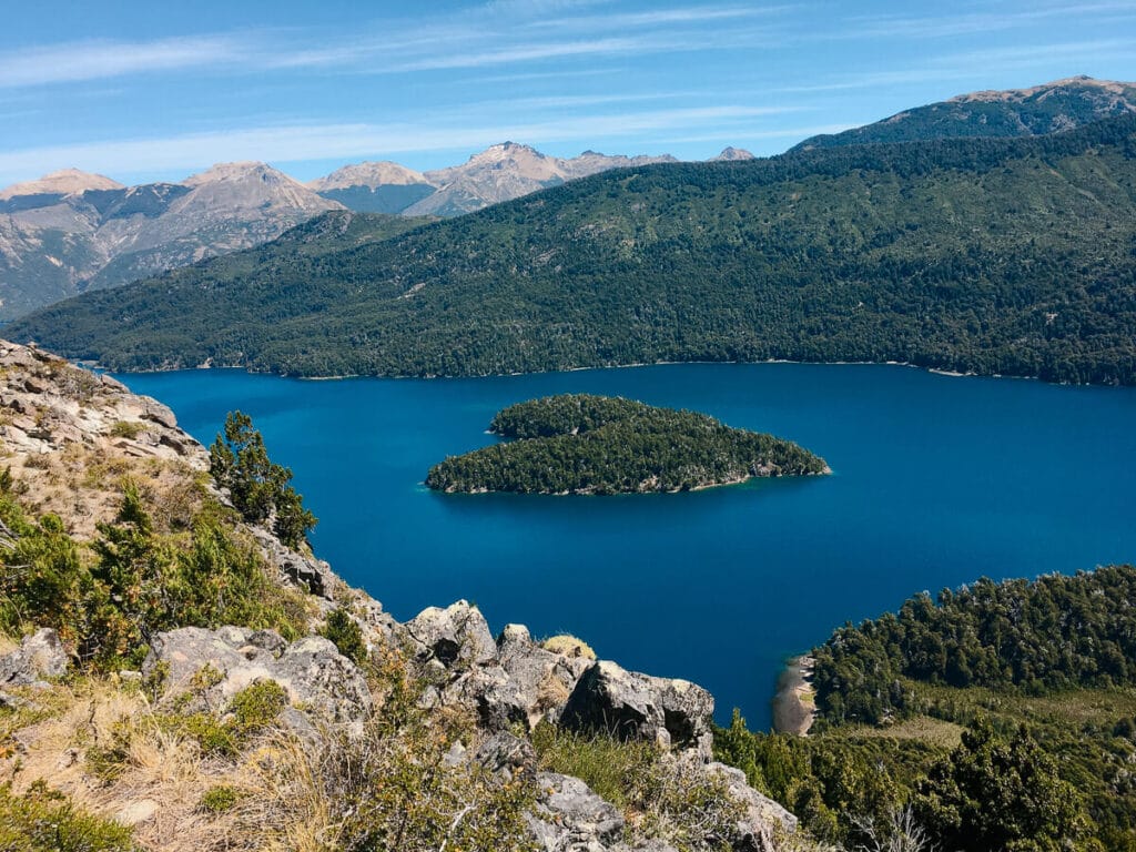
Isla Corazon / Isla Piuké Huapi (Heart Island)
Distance: 13.5 miles roundtrip
Time: 7 hours
Difficulty: Moderate
Registration needed: Yes
How to Get There: Take route 40 and take a right turn onto a dirt road that leads to Relmu Lafquen camping, where the trail begins (15 miles and around a 30-minute drive from Bariloche). Pay for parking at the camping administration office.
This is a full day hike, but feels shorter because it’s broken up into 3 destinations: Playa Leones, Laguna Ilum, and Mirador Isla Corazon.
Depart along Lago Mascardi on a trail that leads through the forest to Playa Leones (at 2.75 miles).
Walk through the peaceful forest (1.5 miles) to Laguna Ilum.
The final stretch (2.5 miles) has more elevation and is often not well maintained (wear hiking pants to protect from overgrown vegetation and bring hiking poles like these).
The effort is well-rewarded when you make it to the top and look out to an island perfectly-shaped as a giant heart.
Hiking in Bariloche: A Summary
Thanks for reading!
Bariloche is a vast destination and this guide highlights the hikes that capture the fantastic experiences in this region.
Don’t forget to also read this guide about the 4 Refugios and this hiking guide to Pampa Linda & Cerro Tronador to cover all of the best Bariloche hikes.
I hope you have an incredible visit that makes you want to return to keep on trekking.
Don’t forget to pack an alfajor and chocolate to celebrate at your next mountaintop.
Related Articles, Keep Reading
- The 4 Refugios of Bariloche – Day Hikes & Multi Day Adventures
- Pampa Linda, Bariloche – Hikes, Excursions, and Travesias
- A Detailed Bariloche Travel Guide – What to do, where to stay, and best restaurants
- Where to stay in Bariloche
- Things to do in Villa La Angostura
- The 7 Lakes Route
- Things to do in San Martin de los Andes
- Things to do in El Bolson
- The best hikes in El Bolson
Argentina Travel Resources
- BOOK A CONSULTATION | I offer one-on-one travel consultations to help you plan your trip to Argentina. Pick my brain to get a local’s insight. Click here for more information.
- MY MAP | Buy my interactive map with 300+ pins to have access to the city as I see it. It is an invaluable resource. See more here about how it works.
- AIRPORT TRANSFERS | Having a driver waiting for you is ideal for a stress free arrival, Cesar and his team here is the best option for a driver from Ezeiza or Aeroparque, they are my go-to airport ride!
- TRAVEL INSURANCE | Always travel insured. Anything can happen anywhere and it is scarier and costlier in an unfamiliar country. SafetyWing’s Essential Plan covers unexpected travel and medical emergencies and even offers add-ons like electronics theft or adventure sports. It is the best if you’re coming on vacation. If you’re coming as a digital nomad or an extended stay, you need their Complete Nomad Plan which also covers routine check ups, maternity, mental healthcare and more. Read more: Health Insurance in Argentina
- PHONE PLAN | These days, traveling with data is essential. Especially in Argentina where everything is managed on Instagram and WhatsApp. I recommend this E-SIM card. It’s hassle-free and affordable, for more read how to get an Argentina sim card.
- ACCOMMODATION IN ARGENTINA | booking.com is the most common hotel site used in Argentina and it’s where you’ll find the most options.
- RENTAL CARS | I love using Discover Cars, it is a great platform to compare different rates and providers and I find they have responsive customer service.
- BUS TICKETS | Check Busbud for long distance bus routes and tickets.
- VPN | If you’ll be using a public WiFi connection and want to secure your data, I highly recommend using a VPN, I personally use and have had a good experience with ExpressVPN. I also use it to access Hulu and American Netflix from Argentina.
- FLIGHTS | Always check Google Flights and Skyscanner for flights to and within Argentina. Aerolineas Argentina is the local airline with the most routes. FlyBondi and Jetsmart are two budget airlines with dirt-cheap prices (but expect to pay for every add-on like luggage).
